(view source)High Resolution Vector Mapping
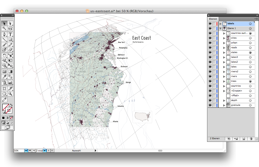
This map was created using the Kartograph SVG renderer. It shows the East Coast of the United States projected in the tilted perspective projection (aka Satellite projection). The rendering took 35 seconds and the resulting SVG has a total size of about 7 megabytes. Labels were added manually in Illustrator.
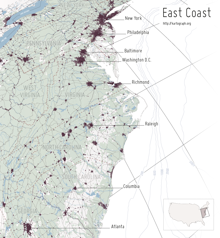
 Please have a look at the map configuration file for more details. The following Public Domain geodata sources are used in the map:
- Admin 0 Countries (Natural Earth)
- Depht Contours (VMAP)
- Trees (VMAP)
- Rivers (VMAP)
- Rivers + lake centerlines (Natural Earth)
- Lakes (VMAP)
- Lakes + Reservoirs (Natural Earth)
- Major Roads (VMAP)
- Urban Areas (Natural Earth)
- City Areas (VMAP)
- Internal US State Boundaries (USGS)
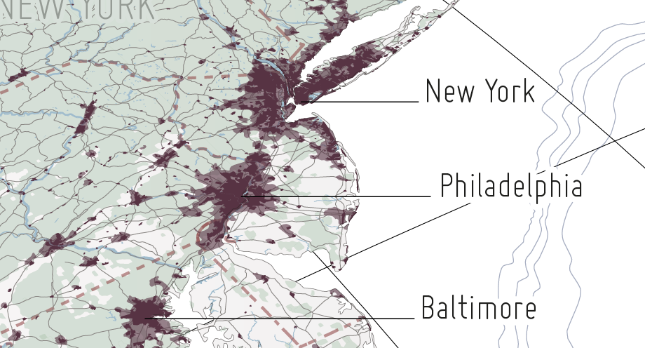
Here's a more detailed sample: